
Trace a Stephenville Street by Address
Begin the address trail with the physical address, not a name. Erath County Appraisal District, known as ECAD, separates Street Number and Street Name and advises a simple street-name search when a complete address fails. Its property result can provide a property or geographic ID and a legal description. Those identifiers are much stronger connectors than a street label alone. An owner-of-record is not necessarily the person who occupies a place, and an owner mailing address may point somewhere else. Keep those roles separate from the start.
The steps use the documented local routes. They move from the address to records that can corroborate one another, while leaving private details out of the process.
- Search the address in ECAD Property Search. Try the number with the street name, then try the simple street name if needed. Record the property ID, geographic ID, and legal description shown on a live result.
- Compare the location in the City of Stephenville GIS. Its published subjects include roads, addresses, parcels, and zoning. A map location is context, not an ownership ruling.
- Use the property identifiers or legal description in the Erath County Recorder Kiosk to look for recorded instruments, dates, and book, volume, or page references.
- Request a copy or certification from the Erath County Clerk when the recorded instrument matters. The clerk is at Annex III, 222 E College Street, and publishes phone, mail, and in-person routes.
- For a voter question, use the individual VoteTexas status lookup or ask Erath Elections about the formal list-request process. A status tool is not a street roster.
Note: Save the search date and source URL with each address result, since online records and street descriptions can change.
Stephenville Street Directory Fields at ECAD
The ECAD form is the main address-entry point for a current parcel search. Its Owner, Address, ID, and Advanced selections support a wide range of parcel questions without turning a street search into a name-only exercise. The district says its database is for research and says legal descriptions and acreage should be verified with ECAD. No online coverage start or end date was displayed in the inspected form, so treat a missing online result as a reason to try the office or another record route.
| Field label | Type | Required | Use or format note |
|---|---|---|---|
| Owner Name | Text/autocomplete | No | Try first or last name alone if a full name fails. |
| Street Number | Text | No | Use with Street Name. |
| Abstract | Autocomplete/list | No | Select from live suggestions. |
| MobileHomePark | Autocomplete/list | No | Select from live suggestions. |
| Property ID | Text | No | Exact identifier route. |
| Property Type | Dropdown | No | Use the live menu for choices. |
| Agent Id | Text | No | Agent identifier. |
| Doing Business As | Text | No | Business-name route. |
| Street Name | Text | No | Simple name search is the stated fallback. |
| Subdivision | Autocomplete/list | No | Select from live suggestions. |
| Condo | Autocomplete/list | No | Select from live suggestions. |
| Owner ID | Text | No | District identifier. |
| Tax Year | Dropdown | No | Choices were not exposed in the capture. |
| Neighborhood | Autocomplete/list | No | Select from live suggestions. |
| Geographic ID | Text | No | Parcel geographic identifier. |
| Hearing Date | Date/text | No | ARB or hearing query field. |
| Board Members | Text/select | No | ARB-related field. |
| Legal Description | Text | No | Search legal-description text. |
The captured controls also include Search, ARB Search, Advanced Search, a main Search button, and per-list Search buttons. A live parcel card was not captured, so do not assume exactly which owner, mailing, value, exemption, image, or sketch fields will appear until the result is open.
ECAD also provides an in-person fallback at 1195 W South Loop, Stephenville, TX 76401-2026. Its published phone is 254-965-5434, and its listed hours are Monday through Friday, 8 a.m. to 4 p.m. Use the office to verify a legal description or acreage when a portal result is unclear.
See the ECAD Property Search form before entering an address query.
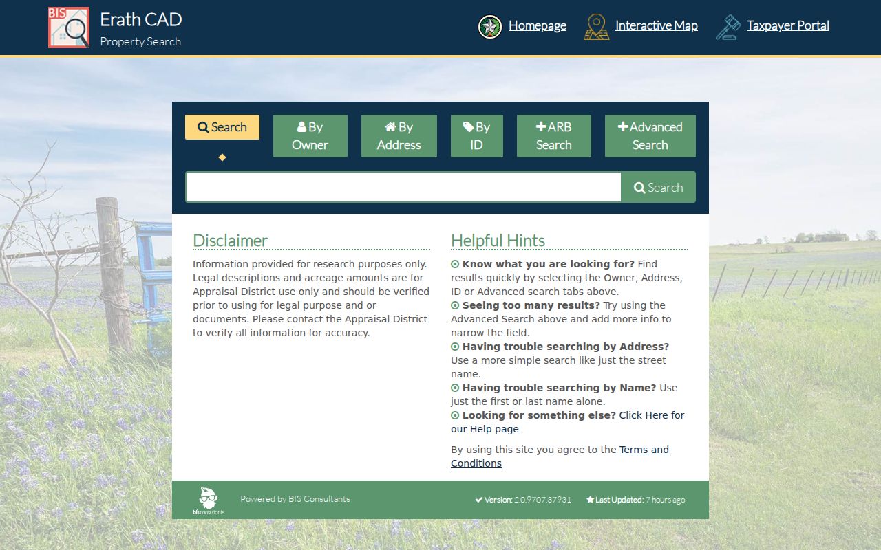
The field groups make it possible to move from a partial street address to a parcel identifier without claiming that the form confirms current residence.
Stephenville Street Maps and Parcel Context
City GIS adds geographic context to an address result. Stephenville describes its GIS work as maintaining roads, utilities, addresses, and parcels for Community Development. The city lists Roads, Addresses, Parcels and Zoning among its map products, along with a thoroughfare plan and other public maps. Use the published map subjects to check whether an address, road, parcel shape, or zoning context belongs together before taking the next record step.
The ECAD interactive viewer timed out during the research inspection. Its live layer names, parcel-click fields, search controls, and any adjacent-parcel, measure, or buffer feature were not verified. That gap matters. Do not describe a marker or polygon as an official owner result, and do not promise a map function that has not been confirmed. For a disputed address, the county staff directory lists 911 Addressing and Maps at 254-434-5019; ask the proper county or city office for the official assigned-address record.
Note: Preserve the source spelling of a road, then test standard street-suffix variants only as a search aid.
Stephenville Street Records at One Address
No single address record identifies every connection to a parcel. The useful public layers have different keepers and different limits. Start with the layer keyed to the question, then move only when the next record can verify or clarify the first one. The table separates current parcel evidence, recorded documents, municipal address records, and dated historical materials.
| Address record | Custodian | What it can show | Access route |
|---|---|---|---|
| Appraisal parcel card | Erath CAD | Owner name, property or geographic ID, situs fields, legal description, value, exemptions, and hearing fields as available | ECAD search or GIS, with live-result verification |
| Tax record | Tax Assessor-Collector and ECAD | Tax account, billed property, and releasable payment or delinquency context | Tax office and linked online services; public fields were not fully located |
| Recorded deed or index | Erath County Clerk | Grantor, grantee, document type, recording date, locator data, and legal description | Recorder Kiosk, Clerk copy or certification, and historical TSL deed series |
| Plat or subdivision record | County Clerk and ECAD/GIS | Lot, block, subdivision, easement, or dedication geometry | Deed or plat index, map, or office request |
| GIS parcel map | City GIS and ECAD | Parcel geometry, road or address context, zoning, and named map layers | Interactive map, with live mechanics needing verification |
| Permit or inspection | City Development Services | Address-keyed building, trade, sign, or food-service event | Citizen Requests-Permit route or department request |
| Code enforcement | City Code Enforcement | Address-linked notice, action, and violation class where releasable | City public-information request or department route |
| Foreclosure posting | County Clerk, trustee, or Tax Office | Notice, sale date or location, and property legal description | Monthly scanned postings and courthouse notice route |
| Historical directory | Library, archive, or newspaper | Listed occupant or subscriber, address, phone, business, or occupation for its edition date | TSL, Tarleton, ECGS, or Portal holdings; coverage is incomplete |
The chain is strongest when the property or geographic ID leads to a legal description, the description leads to a recorded instrument, and the dated image or official copy confirms the index. City permit and code records can document an event at an address, but they are not occupancy logs.
Stephenville Street Permit Record Routes
City records can add a narrow address event to a parcel trail. Development Services and the city's Permitting route document the path for building, trade, sign, and food-service permit activity. Code Enforcement can hold an address-linked notice or action where it is releasable. These records may confirm that a city process touched an address. They are not an occupancy log and should not be used to infer a private person's presence.
No public searchable permit or code-case result index was located in the research sweep. Use the city department route first. For a defined city record that is not posted, the Stephenville Public Information Request channel is the fallback. Identify the department, exact address, record type, and time range, and ask for the available format. A precise request is more useful than a broad demand for all records on a street.
Stephenville Street Deed Index Trail
The County Clerk recorder kiosk provides an additional address-to-deed path when an address search needs a document trail. It accepts Owner, Ranch or Business Name, License Number, Brand Description, Book, Volume, Page, recording-date range, Document Types, advanced name searching, and Exact Match or Wildcard search type. For an owner name, the portal instructions recommend Last First without punctuation. A broad search can use the last name and first initial, while a business or ranch name should be entered as spelled.
The kiosk describes its index as a finding aid, like a library-card catalogue, and warns that indexing can contain errors or changes. Use spelling variants. When an index hit matters, obtain the filed instrument or a certified copy rather than treating the search result as final proof. The County Clerk publishes a $1-per-page copy fee and a $5 added certification fee, both subject to confirmation against the current schedule. Online coverage dates were not stated in the visible portal.
Review the Erath County land-index disclaimer before searching the deed trail.
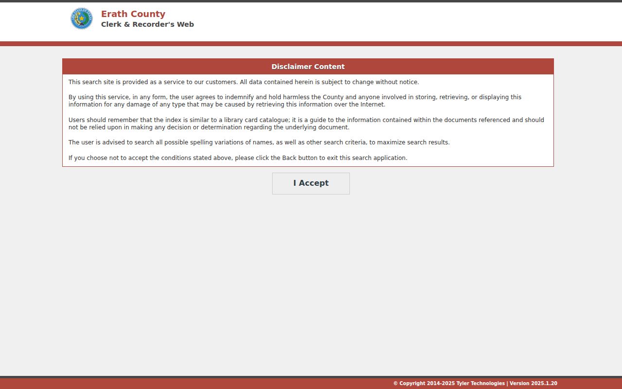
The disclaimer is a reminder to test variants, save the locator, and confirm the recorded document with the clerk instead of relying on a bare index entry.
Stephenville Street Record Terms
Address records use labels that are easy to blur together. These distinctions keep an address result tied to the right kind of evidence.
- Parcel
- A defined piece of land tracked by an appraisal or map system, often with its own property or geographic ID.
- Situs address
- The physical parcel or building location described by a map, permit, code record, or property record.
- Legal description
- Lot, block, subdivision, or metes-and-bounds language used in deeds and plats. It can remain useful when an address changes.
- Plat
- A recorded map that can show a subdivision, lot, block, easement, or dedication layout.
- Criss-cross directory
- A reverse-style historical directory that begins with an address and lists a dated occupant or subscriber where the edition includes one.
A mailing address may be a separate notice destination for an owner. It can help locate an administrative record, but it does not prove that the owner is present at the situs address.
Stephenville Street Names as Map Clues
Stephenville was laid out in July 1855 with Floral and Green identified as original streets around a central square. The city history also identifies early Washington and Belknap locations. Those names are useful map and newspaper clues when a historical address does not match modern wording. Washington remains the historic downtown commercial strip, while Long runs parallel several blocks south according to the comprehensive plan.
The Texas State Library Stephenville map catalogue lists a c.1850 town map, 1890 sheets, and later 1961, 1965, 1972, 1989, and 1993 maps. Catalogue dates describe the maps, not a continuous address history. Compare an old street name with its cross street, the deed legal description, a plat, and the current parcel rather than silently modernizing the record.
This local history is a geography check: Stephenville streets can be read through the town square, campus and highway corridors, city limits, county records, and postal geography. Each layer answers a different question.
Stephenville Street Directory History Layer
A current address trail can stop at the limits of modern portals. For a dated listing, the Texas State Library verifies a Stephenville city-directory holding for 1940, while the Texas State Library Erath guide identifies deed records from 1867 to 1902 with direct and reverse indexes. Historical material should be labeled by edition or recording date. It may connect a person or business to an address at that time, but it does not establish a present connection.
The historical collections themselves are described in the Stephenville Directory Book. Use that directory layer after preserving the modern address and parcel identifiers, so the historical search has an address, cross street, legal description, or name variant to test.
Note: An older address that fails to map should be compared against a historic map, road name, plat, and legal description before assuming a move.
Limits of a Stephenville Street Directory
An address-record chain can connect public property and historical records, but it cannot prove every relationship to an address. ECAD distinguishes property information from owner information, and a live result is needed to learn which mailing fields appear. City GIS and a deed index supply parcel and document context, not a complete list of people at a location. The public voter route has privacy rules and protected records. Do not turn an owner field, map marker, old listing, or postal ZIP into an assertion about who currently lives there.
Texas law also restricts the use of motor-vehicle personal information. The Driver's Privacy Protection Act bars adding DMV address data to a public-record chain except under its statutory permitted uses. Texas Address Confidentiality and protected-voter procedures can use a substitute address or suppress information. Never try to defeat a suppression flag, access control, sealed filing, or protected-record rule.
Lawful use. Use Stephenville address records for personal, lawful research such as property history or a family connection. Do not use them to stalk, harass, threaten, or expose a protected address.